Topographic Survey
Most of the measurements are done with a state-of-the-art GPS unit and/or with a high-quality Total Station. The results of the survey are presented in the form of contour lines on maps of the land. At the request of the owner an AutoCad file can be sent to an architect or engineer for incorporation into their drawing(s).
Topographic Survey
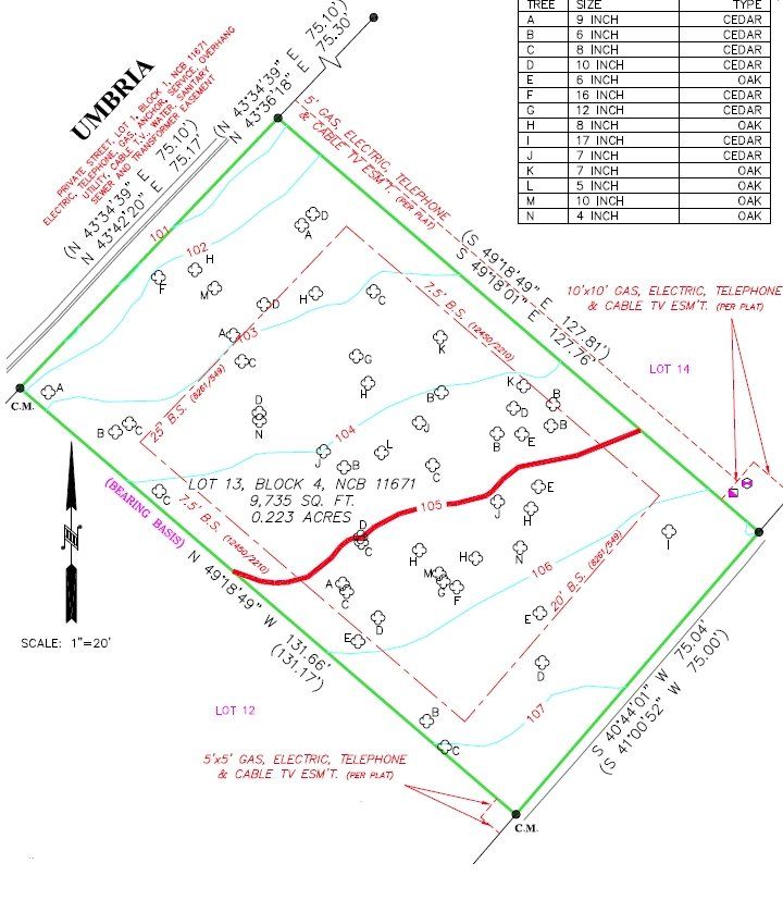
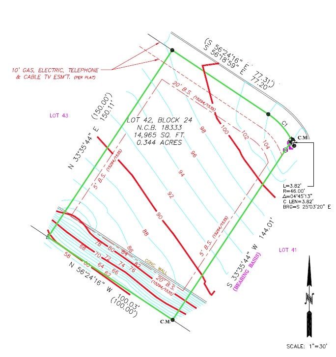
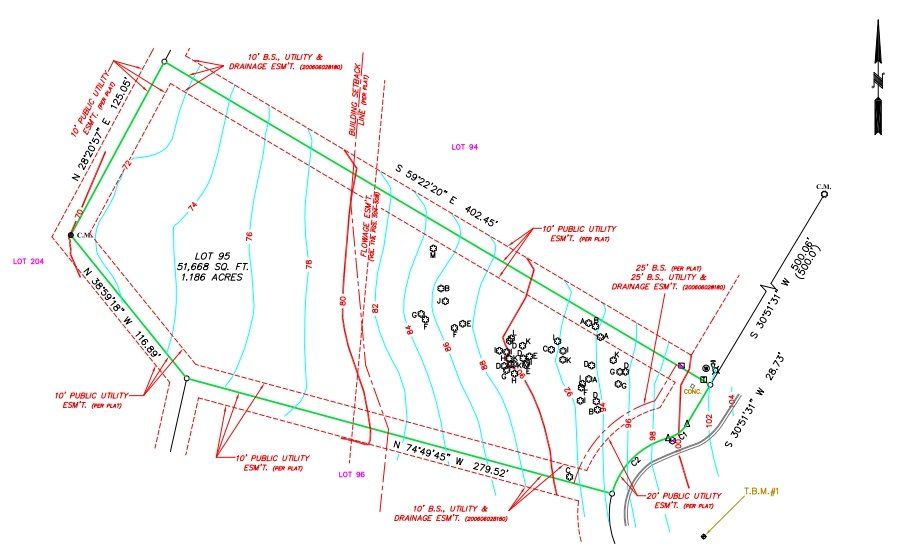
Tree & Topographic Survey
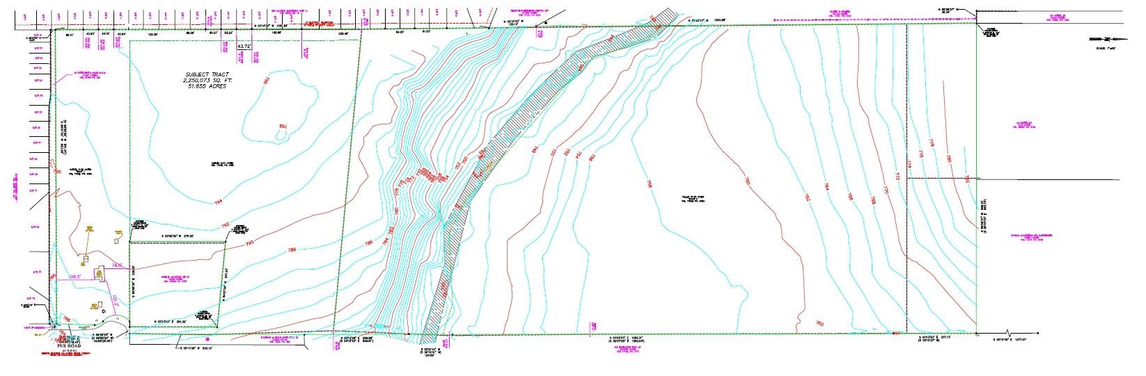
Topographic Survey
Topographic Survey